Atlantic Hurricane Season

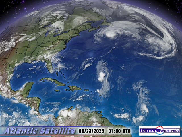
I just noticed on a Disovery Channel program, a reference to a huge Typhoon in Taiwan in September, 2008; they are just now recovering from another storm, the same as our Hurricanes, I wonder if that says anything climate wise?

Amicus

They are having Typhoons in East Asia at the moment. A lot of lives lost in Taiwan and South China.

Is there any difference between a Typhoon and a Hurricane technically . I read somewhere that Typhoons tended to be bigger and more destructive but is that correct?


Memorable and highly destructive hurricanes:

Galveston, 1900
galveston_1900_map.gif


The Hurricane of '38
new_england_1938_map.gif


Donna, 1960
donna_1960_map.gif


Agnes, 1972
agnes_1972_map.gif


Katrina, 2005
katrina_2005_map.gif


You forgot Rita and Ike.


That's a tragic story.

Swimming in the ocean always burns an astonishing amount of energy. People amaze me with their lack of respect for Mother Nature ( in all her manifestations ). The power of the ocean is nothing to fool with.

Even something as simple as body surfing can have fatal/life-altering consequences. There are quadraplegics out there who can testify to that fact. Fatalities, obviously, can only speak to the still living.


I used to do a lot of ocean swimming when I was younger, I am no way strong enough to do so now. Years of only swimming in pools, lakes and slow moving rivers have spoiled me. Doubt I could even swim across a small lake these days. My canoeing and kayaking probably are probably shot too...
 
They are having Typhoons in East Asia at the moment. A lot of lives lost in Taiwan and South China.

Is there any difference between a Typhoon and a Hurricane technically . I read somewhere that Typhoons tended to be bigger and more destructive but is that correct?

Both typhoons and hurricanes are tropical cyclones; the major difference is geography. While typhoons can occur at any time of the year, the prime seasons for both are essentially identical.


From: http://www.aoml.noaa.gov/hrd/tcfaq/A1.html

What is a hurricane, typhoon, or tropical cyclone?
Contributed by Chris Landsea, NOAA

The terms "hurricane" and "typhoon" are regionally specific names for a strong "tropical cyclone". A tropical cyclone is the generic term for a non-frontal synoptic scale low-pressure system over tropical or sub-tropical waters with organized convection (i.e. thunderstorm activity) and definite cyclonic surface wind circulation (Holland 1993).

Tropical cyclones with maximum sustained surface winds of less than 17 m/s (34 kt, 39 mph) are called "tropical depressions" (This is not to be confused with the condition mid-latitude people get during a long, cold and grey winter wishing they could be closer to the equator ;-)). Once the tropical cyclone reaches winds of at least 17 m/s (34 kt, 39 mph) they are typically called a "tropical storm" and assigned a name. If winds reach 33 m/s (64 kt, 74 mph)), then they are called:

"hurricane" (the North Atlantic Ocean, the Northeast Pacific Ocean east of the dateline, or the South Pacific Ocean east of 160E)
"typhoon" (the Northwest Pacific Ocean west of the dateline)
"severe tropical cyclone" (the Southwest Pacific Ocean west of 160E or Southeast Indian Ocean east of 90E)
"severe cyclonic storm" (the North Indian Ocean)
"tropical cyclone" (the Southwest Indian Ocean)


See also [ NOAA hurricane "FAQs" ]: http://www.aoml.noaa.gov/hrd/tcfaq/tcfaqHED.html

Wikipedia also has a decent discussion: http://en.wikipedia.org/wiki/Tropical_cyclone

William Gray, Ph.D. is one of the pioneers of hurricane research ( in addition to being a leading and vocal skeptic of the theory of anthropogenic global warming ):
http://hurricane.atmos.colostate.edu/
FAQs: http://hurricane.atmos.colostate.edu/Includes/Documents/Publications/CSU Forecast FAQ.html


Last edited:
A rip current is a powerful current that flows out perpendicular to the shore. It's caused by a lot of water trying to squeeze through a narrow break in the sea floor or sandbar. The way to deal with a rip current is to just swim out of the very narrow rip current, that is, parallel to the beach.

Many people die each year, because they have no idea how to deal with a rip current.

My wife and I talked about this Sunday. We were on the pier and the lifeguards were having the surfers move to the north side due to a rip current. I grew up in Florida, my wife Chicago, so I was explaining why they had to move. (Rambling, sorry to the point now.)

She asked if all the lifeguards, the two boats, the two jet skis, the towers, etc. were really necessary to public safety or was it superfluous spending. I admit, where I live now in California does spend a lot more than Florida (at least it seems), but I thought her point was valid.

How many other countries have fleets of lifeguards on every beach? And if they don't what is the death toll in comparison?

I did point out that we are a bit more letigous than, say, Costa Rica, where I've never even seen a lifeboat, let alone a lifeguard. But, I thought it made for an interesting compare/contrast.

I guess the key question is how much do we spend per beach-goer compared to other countries, and are we actually safer for it? I would presume yes, but you never know.
 
Gee in WWII my Dad was told a Hurricane was Atlantic and a Typhoon was Pacific.
He went through both and said the Typhoon was larger and stronger.
 

At the moment ( 18 August ), it wouldn't be a very bright idea to set sail for Bermuda from the U.S. East Coast. You might easily become a nominee for a Darwin Award.

 
Last edited:
LARGE SWELLS ASSOCIATED WITH BILL WILL BE IMPACTING THE ISLANDS OF THE NORTHEAST CARIBBEAN SEA DURING THE NEXT DAY OR TWO. LARGE SWELLS ASSOCIATED WITH BILL SHOULD ALSO BEGIN TO AFFECT BERMUDA AND PORTIONS OF THE SOUTHEASTERN COAST OF THE UNITED STATES FRIDAY AND SATURDAY.

HURRICANE BILL ADVISORY NUMBER 16 NWS TPC/NATIONAL HURRICANE CENTER MIAMI FL 500 AM AST WED AUG 19 2009 ...BILL STRENGTHENS TO A CATEGORY FOUR HURRICANE...INTERESTS IN THE LEEWARD ISLANDS AND BERMUDA SHOULD MONITOR THE PROGRESS OF BILL....AT 500 AM AST...0900 UTC...THE CENTER OF HURRICANE BILL WAS LOCATED NEAR LATITUDE 18.0 NORTH...LONGITUDE 54.9 WEST OR ABOUT 460 MILES...
740 KM...EAST OF THE LEEWARD ISLANDS....BILL IS MOVING TOWARD THE WEST-NORTHWEST NEAR 16 MPH...26 KM/HR...AND A GRADUAL TURN TOWARD THE NORTHWEST IS EXPECTED DURING THE NEXT 24 TO 48 HOURS. ON THIS TRACK...THE CORE OF THIS DANGEROUS HURRICANE WILL BE PASSING WELL TO THE NORTHEAST OF THE NORTHERN LEEWARD ISLANDS LATE TODAY AND EARLY THURSDAY.....MAXIMUM SUSTAINED WINDS ARE NEAR 135 MPH...215 KM/HR...WITH HIGHER GUSTS. BILL IS A CATEGORY FOUR HURRICANE ON THE SAFFIR-SIMPSON SCALE. SOME ADDITIONAL STRENGTHENING IS FORECAST DURING THE NEXT 24 HOURS. A NOAA HURRICANE HUNTER AIRCRAFT IS CURRENTLY ENROUTE TO INVESTIGATE BILL...... HURRICANE FORCE WINDS EXTEND OUTWARD UP TO 45 MILES...75 KM...FROM THE CENTER...AND TROPICAL STORM FORCE WINDS EXTEND OUTWARD UP TO 175 MILES...280 KM........THE ESTIMATED MINIMUM CENTRAL PRESSURE IS 948 MB...27.99 INCHES..........LARGE SWELLS ASSOCIATED WITH BILL WILL BE IMPACTING THE ISLANDS OF THE NORTHEAST CARIBBEAN SEA DURING THE NEXT DAY OR TWO. LARGE SWELLS ASSOCIATED WITH BILL SHOULD ALSO BEGIN TO AFFECT BERMUDA AND PORTIONS OF THE SOUTHEASTERN COAST OF THE UNITED STATES FRIDAY AND SATURDAY.

...SUMMARY OF 500 AM AST INFORMATION...
LOCATION...18.0N 54.9W
MAXIMUM SUSTAINED WINDS...135 MPH
PRESENT MOVEMENT...WEST-NORTHWEST OR 295 DEGREES AT 16 MPH
MINIMUM CENTRAL PRESSURE...948 MB

THE NEXT ADVISORY WILL BE ISSUED BY THE NATIONAL HURRICANE CENTER
AT 1100 AM AST.

$$
FORECASTER BEVEN
 
Last edited:
( Fair Use Excerpt )
NYC Closes Beaches to Swimmers as Hurricane Bill Swells Surf
By Chris Dolmetsch

Aug. 21 (Bloomberg) -- New York City closed six beaches to swimming today as Hurricane Bill approached, and said shutdowns are possible through this weekend because of high waves, heavy surf and rip currents.

The Coney Island and Manhattan beaches in Brooklyn have been shut, along with Rockaway Beach in Queens and Midland, South and Wolfe’s Pond beaches in Staten Island, the city’s Parks & Recreation Department said in a statement.

Bill had sustained winds of 110 miles (177 kilometers), making it a Category 2 storm, the U.S. National Hurricane Center said in its latest advisory. It closed in on Bermuda today on a track off the U.S. East Coast that will take it to Canada this weekend.

The National Weather Service said the storm may create seas as high as 10 feet (3 meters) at ocean beaches in New York City and on Long Island...

Full story: http://www.bloomberg.com/apps/news?pid=20601110&sid=aQk5jNq9YKks
 
From that map, it's clear than anyone who wants to live on the beach one the East Coast should choose the DelMarVa peninsula.
 
Sittin' and waitin' to see if the Lewes Ferry is running tomorrow. High surf today on the New Jersey beaches.
 

Danny— previously a loosely organized depression in the western Atlantic— attained named storm status. It may threaten the Outer Banks and the Mid-Atlantic by the weekend.
ADVISORY NUMBER 1 ...1100 AM EDT WED AUG 26 2009
...THE AREA OF DISTURBED WEATHER EAST OF THE BAHAMAS BECOMES TROPICAL STORM DANNY...
143059.gif
 
Last edited:
Gee in WWII my Dad was told a Hurricane was Atlantic and a Typhoon was Pacific.
He went through both and said the Typhoon was larger and stronger.

The word Typhoon, comes from the (Japanese ?) word Tyfun, meaning "great wind". The name kinda' stuck.
 

Erika lies 390 nautical miles east of the northern Leewards.

204712.gif


THE CENTER OF ERIKA IS EXPECTED TO REMAIN TO THE NORTHEAST OF THE LEEWARD ISLANDS....MAXIMUM SUSTAINED WINDS ARE NEAR 50 MPH...85 KM/HR...WITH HIGHER GUSTS. SOME SLOW STRENGTHENING IS FORECAST DURING THE NEXT COUPLE OF DAYS....SUMMARY OF 800 PM EDT INFORMATION...LOCATION...17.2N 57.3W
MAXIMUM SUSTAINED WINDS...50 MPH
PRESENT MOVEMENT...NEARLY STATIONARY
MINIMUM CENTRAL PRESSURE...1004 MB

 
Last edited:
We had one swept away from NC beaches by Bill and one by Danny. They don't hit and still kill people. :rolleyes:
 
Yep watching this one as well but I'm not overly worried. The tracks and forecasts don't look too bad so far. (Although that can change fairly quickly.)

Here's another good tracking map:

http://www.stormpulse.com/

It updates automaticaly and if you play with it you can find a lot of information.

Cat
 
TROPICAL STORM FRED
NWS TPC/NATIONAL HURRICANE CENTER
500 AM AST...0900 UTC...TUE SEP 08 2009

...FRED STRENGTHENING OVER THE FAR EASTERN TROPICAL ATLANTIC...THE CENTER OF TROPICAL STORM FRED WAS LOCATED NEAR LATITUDE 11.8 NORTH...LONGITUDE 27.3 WEST OR ABOUT 285 MILES...460 KM...SOUTHWEST OF THE SOUTHERNMOST CAPE VERDE ISLANDS.

FRED IS MOVING TOWARD THE WEST NEAR 15 MPH...24 KM/HR. A GRADUAL TURN TOWARD THE WEST-NORTHWEST AND NORTHWEST WITH A DECREASE IN FORWARD SPEED IS EXPECTED OVER THE NEXT COUPLE OF DAYS.

SATELLITE IMAGES INDICATE THAT THE MAXIMUM SUSTAINED WINDS HAVE INCREASED TO NEAR 50 MPH...85 KM/HR...WITH HIGHER GUSTS. ADDITIONAL STRENGTHENING IS FORECAST...AND FRED COULD BECOME A HURRICANE OVER THE NEXT COUPLE OF DAYS.

ESTIMATED MINIMUM CENTRAL PRESSURE IS 1000 MB...29.53 INCHES.

MAXIMUM SUSTAINED WINDS...50 MPH
 
According to the White House Economic Advisors Tropical Storm Fred is only a minor bump in the larger scheme of weather realated transactions. Those critics of doom at the National Weather Service, who are spreading evil rumors that Fred it becoming the "Great Depression of 2009" are just silly. At most Fred will only be a "Tropical Recession" with no lasting damage to the Economic Recovery spured by President Obama's Stimulus Package which bailed out no one other than his most valuable supporters.


Traditionally, the Atlantic hurricane season ends on 1 November. Vessels making passages to winter in the Caribbean typically wait until that date to make their departures from the East Coast of North America.
TROPICAL DEPRESSION IDA
NWS TPC/NATIONAL HURRICANE CENTER MIAMI FL AL112009
1000 PM EST THU NOV 05 2009

SURFACE OBSERVATIONS AND CONVENTIONAL SATELLITE IMAGERY INDICATE
THAT IDA HAS WEAKENED TO A TROPICAL DEPRESSION. WHAT REMAINS OF THE DIMINISHING DEEP CONVECTION IS CURRENTLY CONFINED TO NORTHWEST AND NORTHEAST QUADRANTS. SOME FURTHER WEAKENING IS LIKELY DURING THE NEXT 12 TO 24 HOURS AS IDA CONTINUES ON A GENERAL NORTHWARD TRACK OVER NORTHEASTERN NICARAGUA AND EASTERN HONDURAS. AROUND THE 36 HOUR PERIOD...THE CYCLONE SHOULD EMERGE OVER THE NORTHWEST CARIBBEAN SEA AND...ASSUMING THE CIRCULATION IS NOT TOO SEVERELY DISRUPTED BY ITS PASSAGE OVER LAND...THE SYSTEM SHOULD RESTRENGTHEN INTO A TROPICAL STORM.
I completely missed tropical storms Grace and Henri as both were extremely brief and posed no real threat. Grace formed in the Eastern Atlantic off Spain and went NORTH! Henri's maximum winds never exceeded 50 mph.
MONTHLY TROPICAL WEATHER SUMMARY
NWS TPC/NATIONAL HURRICANE CENTER MIAMI FL
700 AM EST SUN NOV 01 2009

FOR THE NORTH ATLANTIC...CARIBBEAN SEA AND THE GULF OF MEXICO...
IN TERMS OF NUMBERS...TROPICAL CYCLONE ACTIVITY DURING OCTOBER WAS NEAR AVERAGE WITH TWO NAMED STORMS. HOWEVER...NEITHER OF THESE STORMS BECAME HURRICANES...WHEREAS THE AVERAGE FOR OCTOBER IS ONE HURRICANE. IN TERMS OF ACCUMULATED CYCLONE ENERGY...ACE...WHICH MEASURES THE COMBINED STRENGTH AND DURATION OF TROPICAL STORMS AND HURRICANES...OCTOBER ACE WAS WELL BELOW NORMAL AT ONLY 18 PERCENT OF THE LONG-TERM MEAN DUE TO THE SHORT DURATIONS OF TROPICAL STORMS GRACE AND HENRI.


A November hurricane! I'll be damned. Well, it has been an unusual season.

HURRICANE IDA SPECIAL ADVISORY NUMBER 19 NWS TPC/NATIONAL HURRICANE CENTER MIAMI FL 1200 PM CST SUN NOV 08 2009 ...HURRICANE WATCH EXTENDED EASTWARD ALONG THE NORTHERN GULF COAST...IDA STRENGTHENS A LITTLE... AT 1200 PM CST...1800 UTC...A HURRICANE WATCH HAS BEEN ISSUED EAST OF THE MISSISSIPPI/ALABAMA BORDER TO MEXICO BEACH FLORIDA. A HURRICANE WATCH IS NOW IN EFFECT FROM GRAND ISLE LOUISIANA TO MEXICO BEACH FLORIDA. THIS WATCH DOES NOT INCLUDE THE CITY OF NEW ORLEANS. A HURRICANE WATCH MEANS THAT HURRICANE CONDITIONS ARE POSSIBLE WITHIN THE WATCH AREA...GENERALLY WITHIN 36 HOURS.
160225W5_NL_sm.gif
 
Last edited:
What's that make this season? Three or four? What happened to the record season? What happened to the storms of the century? What the fuck happened Al Gore? Please, please tell me oh great scientist that you are?!?!
 
Back
Top